Join us as we review the intense winter weather in New Jersey, including record snowfalls, blizzards, and drought conditions, with State Climatologist Dr. Dave Robinson. Discover the details behind the storms, snowpack, and what to expect in the coming months.
00:00 Introduction to February Weather Roundup 02:00 The February Nor’easter: Impact and Analysis 12:05 Snowpack and Its Effects on Weather Patterns 17:00 Winter Overview: Cold and Snowy Trends 22:55 Drought Conditions and Future Predictions 24:30 It was cold this winter, but…
Recap the month of weather that was. It’s all Jersey, with two of Jersey’s best weather guys. New Jersey State Climatologist Dr. Dave Robinson as well as Meteorologist Joe Martucci, owner of Cup A Joe Weather and Drone take you through the temperatures, rain, snow, coastal flooding and much more every episode. New episodes come out the beginning of every month.
LiveNOW is FOX’s 24×7 streaming channel. I was brought in as an expert to discuss this historically large (in size) winter storm for the United States, and even help them out with their water vapor satellite map. Thanks to anchor Austin Westfall as well as producer Julie Gallagher for the invite!
The first snow of the season at the Jersey Shore is usually something to smile about. It’s light and fun. Maybe just a few flakes in the air or a quick snow shower that melts fast. It makes you think of cozy things: a warm fire, snow on the sand at the beach, or a surprise day off from school or work.
At two weather stations near the Jersey Shore – Atlantic City International Airport and Lower Township – the first snow average is 1.6 inches deep. That’s not much. Most people think it’s more fun than trouble.
However, sometimes the first snow is a big surprise.
Four times at Atlantic City International, and three times in Lower Township, the very first snowy day of the season dropped more than 6 inches. That’s a lot for the first one.
I love snow any time, but a huge first snow can catch everyone off guard. It’s like playing a big game without warming up, or running a race in brand-new shoes. Nobody is ready yet. Meteorologists might miss a forecasting tidbit. Road crews might not put out enough salt and plows. Drivers forget to go slow and careful like they do later in winter. That makes slippery roads extra dangerous.
On average the first real snow at the Jersey Shore waits until the second half of December. However, there are a few times in weather history when snow has been noteworthy and early.
December 5, 2002
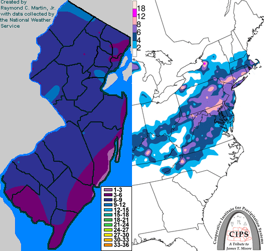
In 2002 the first snow of the season at the Jersey Shore was a nor’easter that dropped more than 6 inches of snow.
Every county in New Jersey had snow, according to NOAA. An area of low pressure developed on a frontal boundary along the Gulf Coast states. Eventually, that low pressure moved through the Southeastern United States, went off the North Carolina coast and quickly raced northeast, according to Raymond C. Martin Jr. It was a nor’easter.
Perhaps more impressive was that these totals were greater than the snow seen the entire previous winter in much of South Jersey. This was in the middle of a long stretch of colder-than-average temperatures. The snow that fell took six days to fully melt across the area as high temperatures stayed below 35 degrees nearly every day from Dec. 4 to Dec. 10.
November 30, 1967
Before 2002, you had to go back 35 years to experience a first winter storm as significant for the Jersey Shore.
At ACY Airport 7.8 inches of snow fell, the second largest leading snowfall of the season on record (a late start in 2022 was higher). Lower Township experienced 3.0 inches of snow.
This is one of the largest first snows on record, and one of the earliest, too. Snow spread from western North Carolina to New England.
This wasn’t a 100% snowstorm; 3.2 inches of snow at ACY Airport mixed with a total of 3.98 inches of precipitation. In essence, about 10% of the precipitation that fell was snow. Still, it counts.
Places farther south saw less snow mixed in. By the time you went to Lower Township, the storm was all rain. The Cape May Bubble was still alive and well then, too.
The New York Times wrote that New York’s highways were covered in an icy sheen and many motorists going upstate had to sleep overnight in their cars.
The storm was tropical at first. It was a tropical depression that moved across Florida. It then transitioned from a warm-core, tropical storm, into a cold-core, nor’easter. Ready for the storm was a huge mass of cold air in the Northeastern United States. That turned what was warm rain into some snow.
December 8, 1928
The third biggest first snow of the season in Lower Township’s long stretch of weather records (back to 1897), was a pure snowmaker, even at the immediate coast.
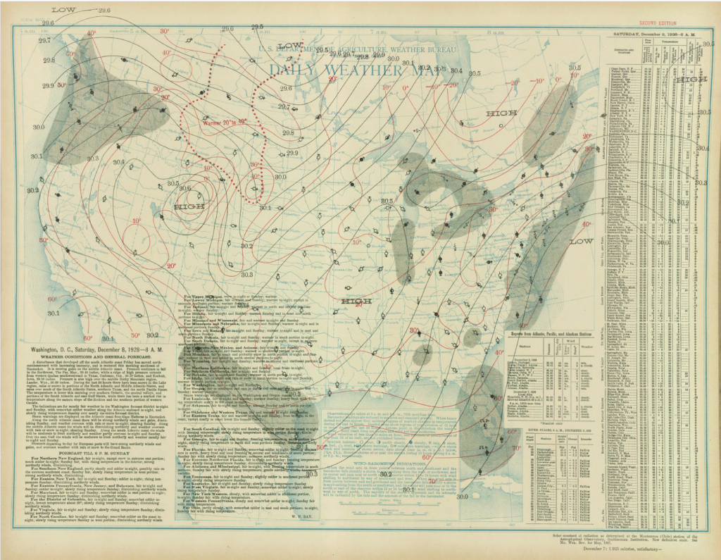
Lower Township saw 9.6 inches of snow on 0.80 inches of precipitation, according to NOAA. That’s a snow ratio of 12:1, meaning this wasn’t a sloppy, wet mess of snow, either.
ACY Airport wasn’t around yet. However, Atlantic City kept snow records then and they were blanketed in 3.9 inches of snow. High temperatures stayed in the 30s for the next two days after that, keeping the snow on the ground, too.
Archive weather maps from NOAA show that this was a coastal storm. Low pressure the morning of Dec. 8 was roughly 40 degrees north latitude, and 75 degrees west longitude. Today, that’s known as the “benchmark,” or the position coastal storms should cross to bring at least some snow to the coast. Winds were from the north or northeast at the Jersey Shore, pumping in the icy air.
The surface weather analysis for the Dec. 8, 1928 snow. The National Weather Service was a part of the United States Department of Agriculture then.
Thanksgiving Day, 1912
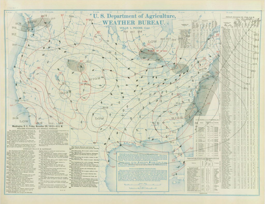
Talk about cold turkey. Nov. 28, 1912, brought a statewide blanket of snowfall, delivering a rare “White Thanksgiving.” In fact, it has an argument to claim a spot as the snowiest Thanksgiving on record statewide.
In Lower Township, 4.5 inches fell. In Atlantic City, Northfield and Tuckerton, 4.0 inches fell.
Barely an inch of snow fell in Taylor Ham land in the northern part of the state (yes, there’s a Central Jersey).
I imagine there were a lot of melted (dirt) roads that turned into ice at night. The days following it were well above freezing during the day, dropping a good bit below freezing at night.
Like the early 1928 snow, this storm was a coastal storm. Known as a Miller A type storm, it began off the Georgia coast. It quickly moved north-northeast, passing almost right at that 40-degree north latitude, 75 degree west longitude benchmark.
The surface weather analysis for the Thanksgiving 1912 snow. The National Weather Service was a part of the United States Department of Agriculture then.
What are your snow thoughts?
Love it? Hate it? You want one snow and then that’s it? Drop me a note on social media or email.
Joe Martucci, a certified broadcast meteorologist and digital meteorologist, is also the president and director of meteorology for Cup A Joe Weather and Drone. You can connect with him at cupajoe.sparkable.opalstacked.com/.
Occasionally, while I’m doing a public talk, I’ll be asked
“What are your thoughts on climate change, Joe?”
And, usually, I’ll respond with something like
“I’m not here to tell you my thoughts on climate change. Let me tell you what’s going on.”
Climate change is not a religion. You don’t believe in it or not.
There are facts and forecasts. Then, there’s what to think, not think, do or not do about it. That’s where your beliefs come in.
My job is the facts and forecasts.
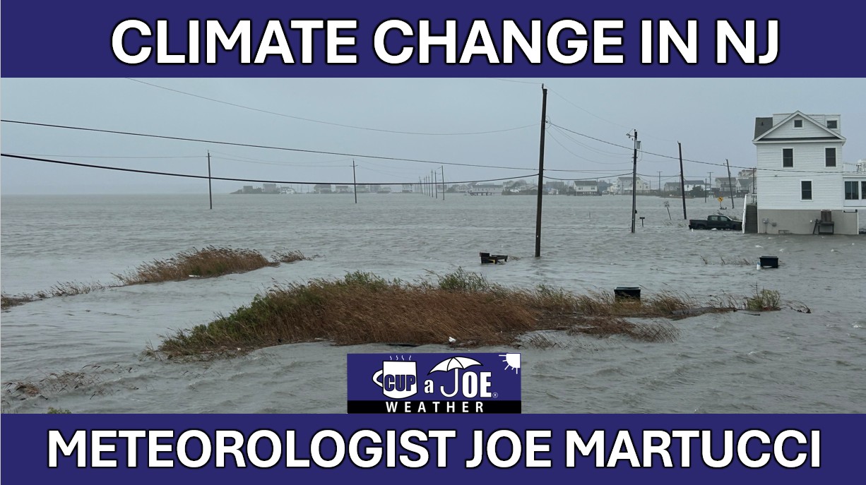
In a warmer, wetter and more extreme New Jersey climate, that’s what I do here in this video series. Thanks for watching and email joe@cupajoe.live with any questions.
The facts and forecast vs. beliefs on climate change
Climate change isn’t a religion, you don’t believe in it or not.
🌀How climate change does, and does not, impact hurricanes
Tropical cyclones has and will see significant changes from climate change. However, climate change does not have its fingerprints on everywhere associated with hurricanes and tropical storms.
🏜️ Climate Change in New Jersey: Drought
More extreme precipitation in a climate changing worlds means drier dry weather and wetter wet weather. However, how much drought we’ve seen hasn’t changed in New Jersey.
🌧️❄️ Climate change in New Jersey: When it rains, it pours and snow is heavier, too.
Climate change has brought more rain and less snow. However, how it rains and snow also changed, too.
🌡️ Climate Change in New Jersey: Temperatures
Since records in NJ began in 1895, the average temperature rose by 4 degrees. Vineyards can now produce grapes are far north as Interstate-78, where in the 1970s, it was mainly limited to Cape May County. However, heat is the biggest killer in the United States on an annual basis and those numbers only get higher, even with air conditioning.
Climate Change in New Jersey: The complete guide
Follow my work: www.cupajoe.live Jolt your brand, advertise with me: joe@cupajoe.live
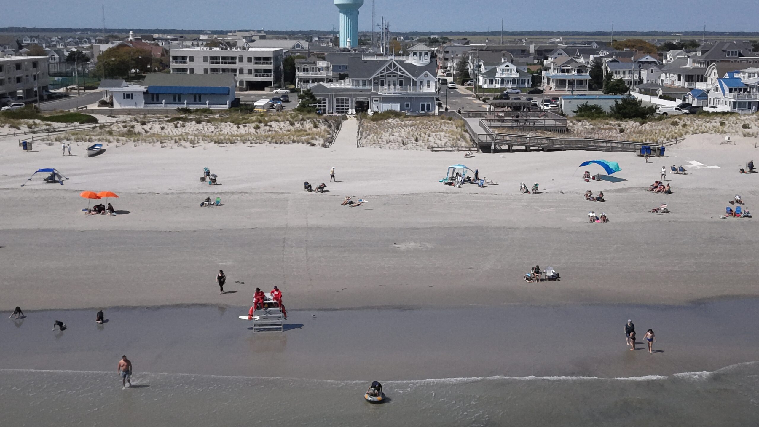
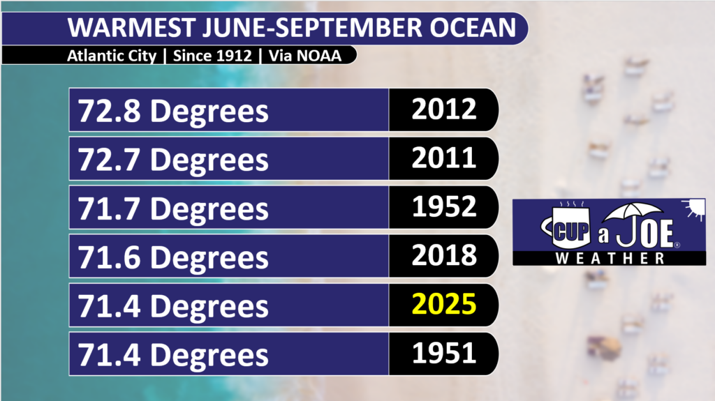
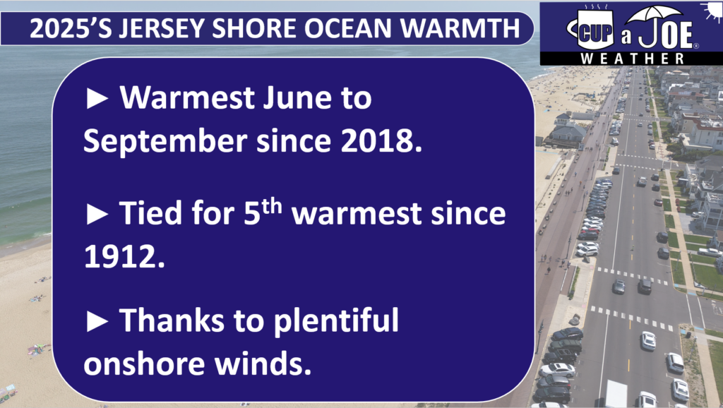
The summer tide came rolling in this year much warmer than 2024. In fact, the water we enjoyed was tropical enough to be one of the warmest on record at the Jersey Shore.
From June to September, peak beach season, the ocean water temperature from the gauge at Atlantic City’s Steel Pier averaged 71.4 degrees. That is tied with 1951 for the fifth warmest season since records began in 1912.
This was exactly five degrees warmer than last year, at 66.4 degrees. Remember last year? The water was cold. You sweated on the sand but shivered in the ocean.
June and July had zero days with a water temperature above 75 degrees last year in Atlantic City. In fact, 11 July days were in the very chilly 50s, and 55 degrees was the 8 a.m. water temperature on July 18, 2024.
The old saying, “life’s at ease with an ocean breeze” is true. Wind direction all summer, and Locals’ Summer September long, play the critical role to this top five ranking.
There are three main factors that drive water temperatures.
The Sun: In spring and summer, the sun is higher in the sky, so it warms up the ocean water faster. In fall and winter, the sun is lower, so the water stays cooler.
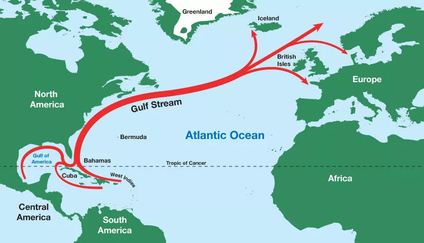
The Currents: In New Jersey, there is a warm ocean current called the Gulf Stream. It starts near Florida and flows all the way to Europe. It does not always reach New Jersey, but sometimes its swirls, bringing warmer water to the shore.
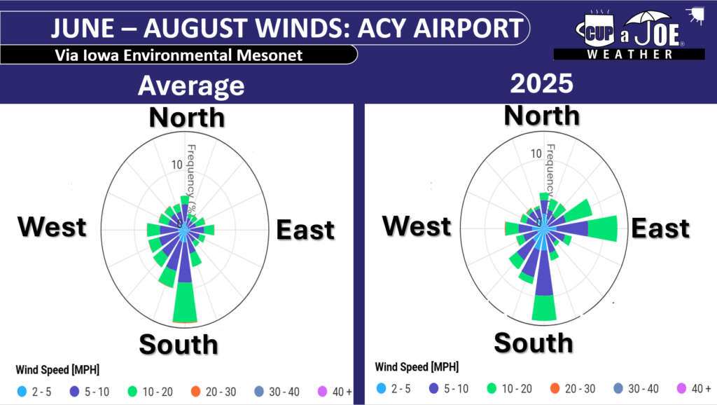
Wind Direction: Winds that blow from the east, called onshore winds, push warmer ocean water toward the beach. But winds from the south or southwest bring colder water. When winds blow along the shore, they can cause something called Ekman Pumping. This pushes warm surface water away and pulls up colder water from the bottom of the ocean, where we swim.
While the sun and currents are constant, the wind direction varies day by day, month to month and, for purposes of this article, year by year. This is why it was warmer.
Onshore winds blew 30% of the time between June and August at Atlantic City International Airport in Egg Harbor Township this year, our closest NOAA weather station with wind direction to Atlantic City.
The average is 15%. In other words, we had double the number of onshore winds as usual.
September was the same, with onshore winds roughly 38% of the time in 2025. 27% is the average.
Those extra onshore winds pushed in some warmer water from the Gulf Stream and limited the amount of colder upwelling. It also led to an August that was cooler than average on land and just about average during September, according to New Jersey State Climatologist Dave Robinson, my other weather dad. Insert YouTube video here.
The average June to September water temperature is 68.6 degrees. June was the only one below average, at 65.8 degrees. That is not a surprise. However, July (72.9), August (74.8), September (72.1) were all above average.
If you had to compare it, the sea surface temperatures you experienced this season were more like an average season for Virginia Beach.
August 16 and 17 were the warmest water days, staying above 80 degrees. June 1 itself had the coldest water, staying below 60 degrees. No surprise there, as the sun is trying to heat up the water.
We are Going Live!
Also, I am extremely excited to say that the Jersey Shore’s first 24×7 livestreaming weather channel is going live soon! Thanks to Sparkable (who also runs the Shore Local Website), everything Jersey Shore weather, with a little drone, will be on my YouTube channel and website for your viewing pleasure.
Tide and marine forecasts, current conditions, forecast videos, radar, and support from our sponsors will all be on there. I also want to see your Jersey Shore photos! Submit your sunrises, snow, thunderstorms and fall foliage to be featured in a special shot on the livestream.
Keep it on your smart TV or computer all day long. Stay tuned for more details.
Meteorology, the study of weather, is a pretty new science, even though the word comes from Ancient Greek, meaning “the study of things high in the air.” In 340 B.C., the Greek philosopher Aristotle wrote a paper called “Meteorologica,” but after that, not much happened in weather science for 2,000 years.
Things began to change in the 1700s when tools like the thermometer (to measure temperature) and the barometer (to measure air pressure) were invented. These tools let people start observing and recording weather data. But progress was slow until the 1830s when Samuel Morse invented the telegraph. This allowed weather information to be shared quickly across long distances, and that’s when modern record-keeping really began. Even so, weather forecasts back then were basic and often wrong.
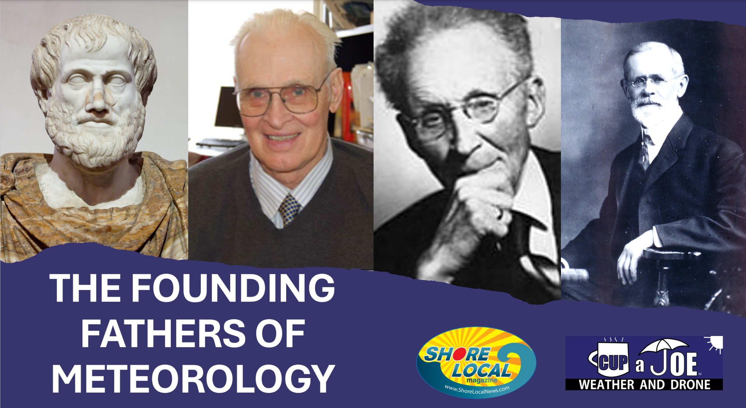
It wasn’t until the 1950s and 1960s, when computers were developed, that meteorology really took off and became the advanced science we know today. Since most of the big discoveries in meteorology happened fairly recently, we have good records of the people who helped shape the field. I chose four important meteorologists to highlight, plus two more who are special to me personally.
In 340 B.C., the Greek philosopher wrote a paper called “Meteorologica,” which became the basis for all modern-day texts on weather for more than 1,300 years. Broken down into four books, the first three, dealt with what we’d now call meteorology, according to H. Howard Frisinger in his 1972 paper in the Bulletin of the American Meteorological Society.
Aristotle was the first major figure to illustrate major weather-related concepts such as:
1) The Earth is a sphere (it’s really slightly oval but this is close enough).
2) Astronomy had to do with what we now know as outer space, and meteorology had to do with what we now know as the atmosphere.
3) Weather varies by region and seasons based on latitude and proximity to water.
4) Wind is air in motion.
5) How the water cycle works. He noted that water evaporates from the Earth’s surface due to the sun’s heat, cools in the atmosphere and falls back to earth as precipitation.
He didn’t get everything right. For example, he believed that earthquakes were caused by underground winds. It’s also important to note that not all of these ideas were his own. Frisinger notes that some came from the Egyptians and the Babylonians. Still, he was the first to curate all of this into a text that would be cited frequently until the 1700s and even later. You can’t have a list of greatest meteorologists without including him.
Cleveland Abbe
The current conditions at your local airport, the surface weather map you see and America’s largest source of employment for weather forecasters are all traced back to Cleveland Abbe
The National Weather Service calls him “America’s First Weather Forecaster.” Born in 1836 in New York City, he attended Harvard University and then moved to Cincinnati, Ohio, in 1868, becoming the director of the Cincinnati Observatory.
He progressed tremendously in the science of meteorology from then on, persuading telegraph operators to report daily weather conditions by using guidelines that he established. That included wind direction, wind speed, type of clouds, sky color, rain amounts, temperatures and barometer readings.
On Sept. 2, 1869, The Cincinnati Commercial newspaper reported weather conditions for four cities. By the end of the month it was nine, and in 1870 it grew to 69. It was the first time the public and scientists alike could know what was happening in other parts of the country in less than a day – tremendous for the time.
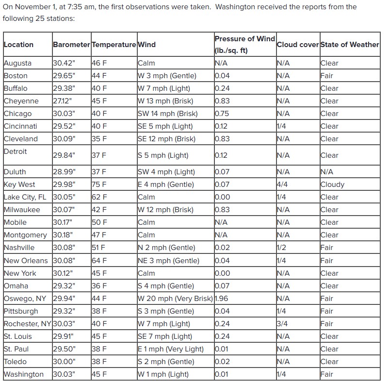
The success was so great that Congress passed a resolution on Feb. 9, 1870 to create a national Bureau of Storm Signals. Under the United States Army, it created stations across the country, taking weather readings three times a year. On Nov. 1, the first observations were reported back to Washington, D.C.
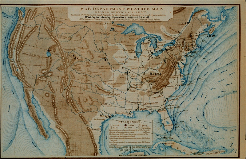
The first United States weather observations that were done across the country at the same time. This is Nov. 1, 1870.
Abbe was then asked by the federal government to begin what we now know as the National Weather Service. He did so in 1870, laying the foundation for meteorology in the United States, and creating standardized methods of data observation and primitive forecasting. He would go on to create the Monthly Weather Review, which still exists within the American Meteorological Society.
The War Department of the United States was responsible for issuing surface weather maps in 1872. Using the small, but national network of observations, early meteorologists plotted air pressure systems and wind direction. (via National Weather Service)
Dr. Vilhelm Bjerknes
To put it simply, modern weather forecasting as we know it does not happen without Vilhelm Bjerknes. The Norwegian (1862-1951) founded the Bergen School of Meteorology in 1917, developing the thought process that essentially created modern meteorology.
Bjerknes, and the Bergen School built on Abbe’s weather mapping, established modern meteorology. They introduced:
1) Cold and warm fronts – narrow zones of weather such as rain or snow separating air masses.
2) The lifecycle of mid-latitude cyclones and low-pressure systems like nor’easters impacting areas from Florida to Alaska.
3) Numerical weather forecasting, using equations to predict future weather from current conditions.
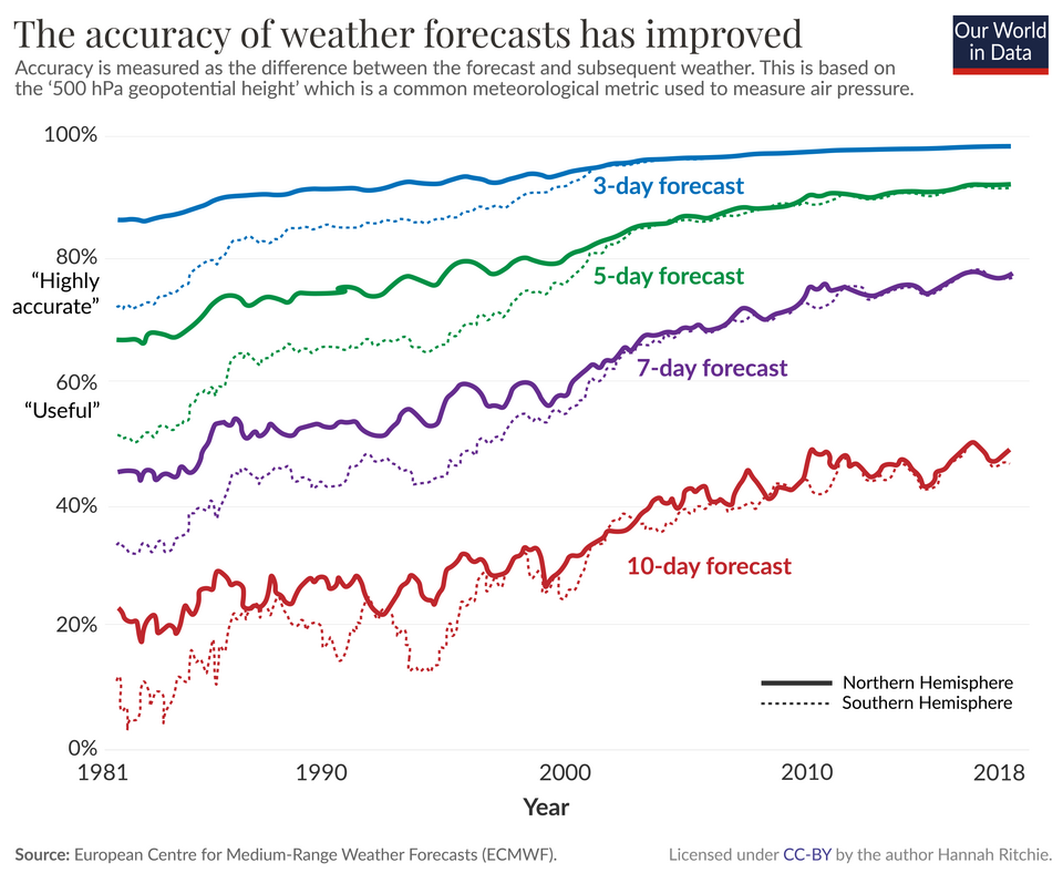
Forecast computer models are more accurate than ever before. This data is from the European model and does not factor in Meterologists, which add skill to these computer model forecasts, too. (Via Hannah Ritchie on Wikipedia)
Bjerknes’ equations were visionary, but incomputable until 1950. The first six-hour forecast was done by hand and took six weeks. Today’s equations are far more precise, powered by computers that are far more powerful than the 1950s versions, delivering fairly accurate forecasts for human meteorologists to refine. Numerical prediction dominates, but artificial intelligence is gaining ground in 2025.
Dr. William Gray
Considered the father of hurricane forecasting, in 1984 William Gray took on what the weather community still couldn’t touch by forecasting the tropical cyclones months out, and made it his own.
A United States Air Force veteran, he earned his PhD in 1964 at the University of Chicago. He then went to Colorado State University, a landlocked state, to research hurricane forecasting.
Gray looked at big patterns like ocean temperatures, El Niño, and rainfall in Africa’s Sahel region, to make seasonal hurricane forecasts, with accuracy. His work helped communities prepare months in advance, saving lives and property.
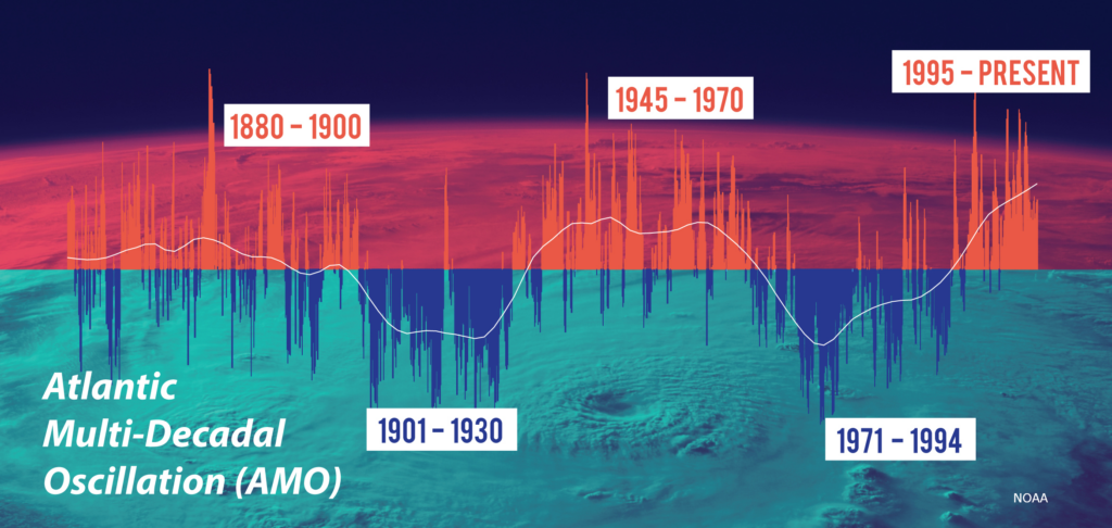
Gray’s methods mixed real-world data with science, making forecasts more accurate. He also discovered that the number of hurricanes in the Atlantic Hurricane Basin go up and down in roughly 30-year cycles. We are currently in a high-activity period. However, it began in 1995, therefore, we should see less activity through the 2030s and 2040s.
The cycles of the Atlantic Multi-Decadal Oscillation. (Via National Oceanic and Atmospheric Administration)
His legacy lives on through his student Phil Klotzbach, who continues the forecasts, and other scientists worldwide who use similar ideas. Gray wrote more than 80 research papers and mentored many meteorologists.
Dr. Dave Robinson
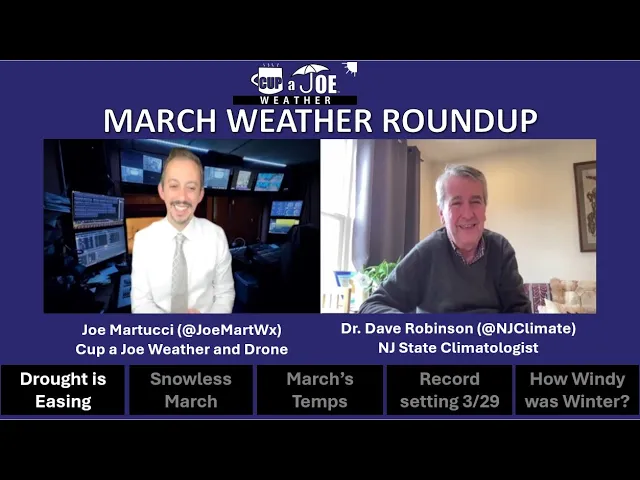
Dave Robinson, the New Jersey State Climatologist and I during our March Monthly Weather Roundup Show you can watch for free. Dave is my birthday buddy (May 13) and weather dad.
Dave Robinson is one of my two “weather dads,” former research advisor and my birthday buddy. Robinson is the New Jersey state climatologist and America’s longest serving state climatologist of all time, a job he took on in 1991. I was born the same year, so he really is my weather dad in a way. He is also a distinguished professor at Rutgers University.
As the state climatologist, he runs the New Jersey Weather Network. Over 60 stations give super specific, up-to-date weather info for local areas. His network is great at catching things like cool sea breezes or strong wind gusts from a single thunderstorm, as well as doing it more frequently than the bigger national weather networks.
He also runs the state’s Community Collaborative Rain, Hail and Snow Network (CoCoRaHS), the nation’s largest citizen scientist program. Some of you are CoCoRaHS members because of his work and outreach. Anytime you see me, another meteorologist, or journalist talk about specific weather or climate conditions in the state, he has his hands on it. Furthermore, he’s been my co-host of the “Monthly Weather Roundup” show online since 2018.
Globally, he’s known for his snow cover resources. He’s the operator of the Rutgers Global Snow Lab. Researchers across the globe use this for their research. Not many people like snow more than he does, and even in New Jersey, he’ll get a good snowshoe in after fresh powder comes down.
Jim Eberwine
Jim Eberwine and I are all smiles in the Joe DiMaggio room at The Irish Pub in Atlantic City!
Jim’s my second weather dad. A United States Marine Corps veteran, he spent decades at the National Weather Service, first at Atlantic City International Airport, and then at Mount Holly, Burlington County, until he retired in 2010.
Jim Eberwine isn’t really retired, though. He helps keep Absecon safe as the emergency management coordinator, teaches a class at Atlantic-Cape Community College and works with the Federal Emergency Management Agency to train others.
Back in the late 1980s and early 1990s, Jim and Dean Iovino, retired lead meteorologist for the NWS, worked together on something cool. They figured out which streets near the coast would flood during nuisance events. They called their project “Operation Crabcake” because they ate crabcakes together while working on it. Their work helped people know when their streets might get flooded just by checking tide forecasts.
Jim walked 127 miles, from Sandy Hook to Cape May, and even other places like Delaware Bay and the Delaware River, recording videos of spots that flood easily. His hard work helped emergency teams and weather experts work better together. People were amazed at how well Jim knew every road’s flooding potential.
If you follow me online, you’ll see me call both Dave and Jim my weather dad. They’re mentors, friends and people that helped me with my professional weather career. I talk to Jim on the phone about once a week, and we text even more.
Jim is South Jersey Shore weather, and, in many ways, his legacy is stronger than ever before.