CHRISTMAS FORECAST: Merry Christmas to everyone celebrating! The weather doesn’t stop and neither do we. We have your full forecast on the winter storm to come Friday evening to Saturday. Something your generic weather app won’t tell you? How post-Christmas travel will be impacted.
Never worry about missing severe weather warnings again. Get a recorded call from me when your location is impacted. WeatherCall ensures you stay informed for just $15 a year. Sign up: https://ngorder.wxriskalerts.com/db_app2.php?station=cajx
WEDNESDAY’S FORECAST | It’s merry and bright for Christmas Eve but that’ll change. A winter storm is on for Kwanzaa and Boxing Day and this will bring an ol’ fashioned slop fest to the Jersey Shore. Snow, sleet, freezing rain and rain will be around. Here’s what I know so far.
Follow my work: www.cupajoe.live Jolt your brand, advertise with me: joe@cupajoe.live
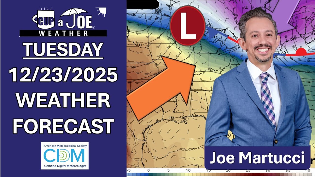
TUESDAY’S FORECAST: Good morning! A little bit of a rain/snow mix may just put ya in the holiday mood now. However, a Boxing Day snowstorm is possible Friday. In between? Good weather for traveling and enjoying.
Follow my work: www.cupajoe.live Jolt your brand, advertise with me: joe@cupajoe.live
FRIDAY PM WEATHER UPDATE: Nearly every beach town gusted over 45 mph. Keansburg gusted to 58 mph! That was a warm wind as the rain fell. Now, temperatures will plummet but the strong winds will continue to whip. Tune in.
Never worry about missing severe weather warnings again. Get a recorded call from me when your location is impacted. WeatherCall ensures you stay informed for just $15 a year. Sign up: https://ngorder.wxriskalerts.com/db_app2.php?station=cajx
FRIDAY MORNING WEATHER FORECAST: Top wind gusts are 48 mph at the Jersey Shore and that only climbs as the day goes on. A few (not all) will have wind damage and power outages issues. The rain? Much needed but it is making the roads slow.
Never worry about missing severe weather warnings again. Get a recorded call from me when your location is impacted. WeatherCall ensures you stay informed for just $15 a year. Sign up: https://ngorder.wxriskalerts.com/db_app2.php?station=cajx
THURSDAY’S FORECAST: We need the rain but not the winds that will come with it. Power outages and wind damage threaten with a Friday storm system. I got the Shore details on that. Plus, it’s a much needed balmy day, again! Highs hit the low to mid-50s.
Never worry about missing severe weather warnings again. Get a recorded call from me when your location is impacted. WeatherCall ensures you stay informed for just $15 a year. Sign up: https://ngorder.wxriskalerts.com/db_app2.php?station=cajx
WEDNESDAY’S FORECAST | Welcome to our warmest day since December 1st. It’s not even that warm but it’ll be enough to melt the snow. We’ll ice back up tonight (watch out) then, we have a wind/rain maker on the way to the Jersey Shore. Follow my work: www.cupajoe.live Jolt your brand, advertise with me: joe@cupajoe.live
TUESDAY’S FORECAST: The bitter blast continues today with highs struggling to freezing. At least the wind will be calm. It’s the 7th coldest December on record but we’ll fall out of the top 10 with a warmup on the way! One thing your generic weather app won’t tell you? A big-time refreeze threat on the way.
Follow my work: www.cupajoe.live Jolt your brand, advertise with me: joe@cupajoe.live
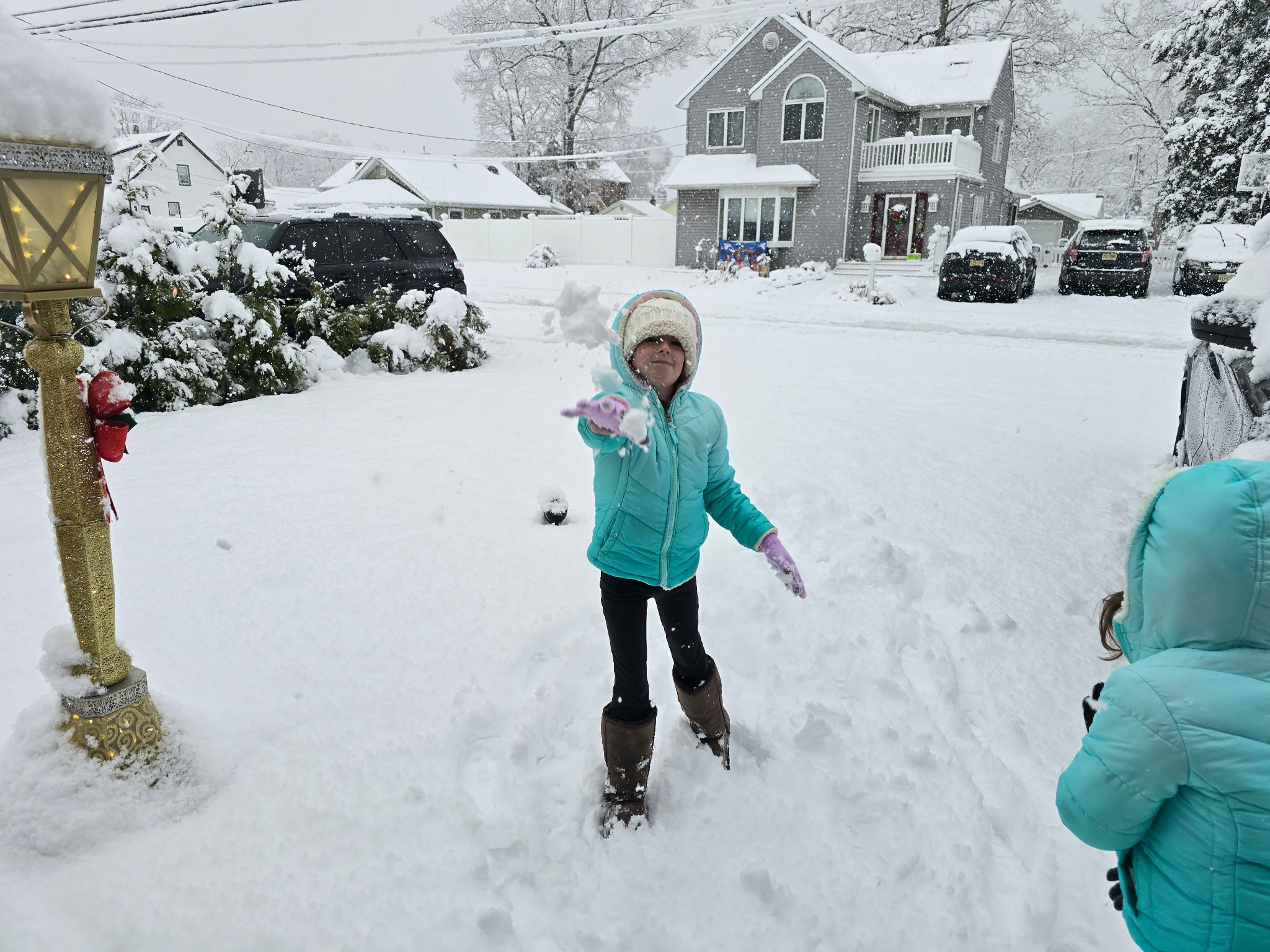
SUNDAY NIGHT FORECAST UPDATE: The snow has settled and it piled high in the northern part of the Jersey Shore. Jackson picked up 8.6″ of snow! Woof. Now, it’s big time cold thanks to a biting wind out of the northwest. Something your generic weather app won’t tell you? How traveling on the rails, roads and skies look tonight.
1:30PM
Snowfall totals will end up between 5″-9″ for most of Monmouth County, with 4″-8″ for Ocean County. Atlantic Count was 2″-4 and Cape May County will be up to 2″.
This overperformed at the northern part of the shore, and really the whole northern half of the state. We’ll talk about that later, though. Here’s a look outside during a livestream I did in the snow.
1150AM Sunday
A WINTER WONDERLAND | Hey, look if there was ever a time to get more snow, it’s a Sunday morning during the holiday season. From Highlands to Cape May, you sent in your photos and videos.
This is what the Jersey Shore looks like!
10AM Sunday
This is turning into a legit winter storm! Over 6″ of snow fell in some parts of the Jersey Shore and it has to do with one band of heavy snow that formed.
10AM Snowfall totals
6.8″ Jackson 6.6″ Upper Freehold 5.7″ Tinton Falls 5.7″ Toms River 5.1″ Lavallette 4″ Hammonton 3.1″ Ocean Acres
730AM Sunday:
SUNDAY SNOW FORECAST UPDATE: Up to 4″ of snow has fallen at the Jersey Shore so far. The rain-snow line exited the coast around sunrise and now, it’s snowing everywhere. Once the snow ends, it’s getting windy. And that means brrrrr. Never worry about missing severe weather warnings again.