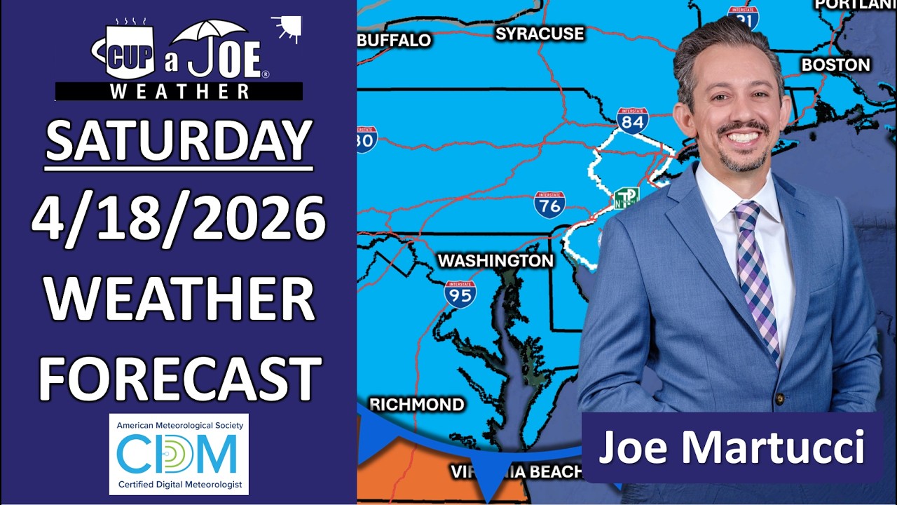
SATURDAY’S FORECAST | Temperatures will be 20, even 30 degrees cooler Saturday than where we were Wednesday and Thursday. Weekend temps will be more like a typical mid-April weekend, though. In other news, coastal flooding returns to the Jersey Shore Saturday evening and we time out when it’ll be dry for your Sunday.
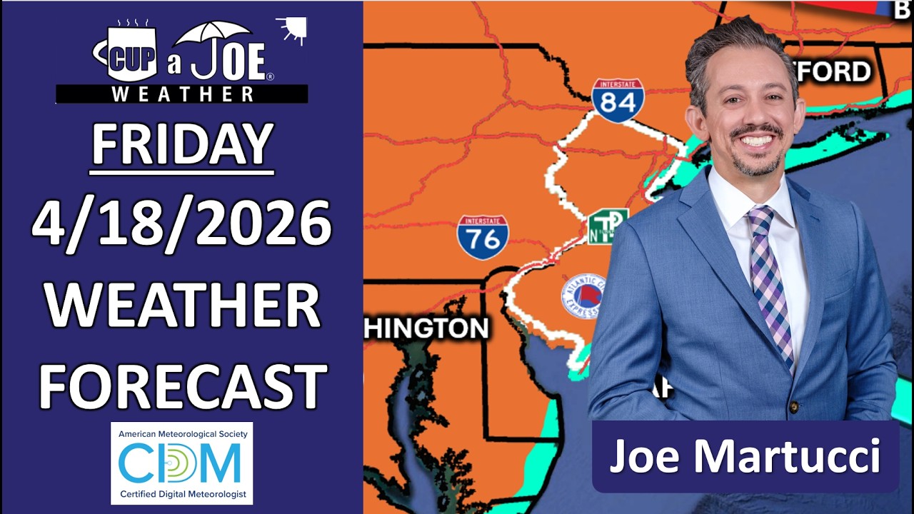
FRIDAY’S FORECAST | Summer breeze, makes us feel fine for 1 more day! Then, back to our regularly scheduled April programming. A few pockets of much needed rain are on the way, too, but it’s not a washout. Let’s talk!
The Atlantic Hurricane season runs from June 1 to Nov. 30. We know that very well here in New Jersey, as does Colorado State University – yes, landlocked Colorado State University which just put out one of the most anticipated hurricane forecasts of the season.
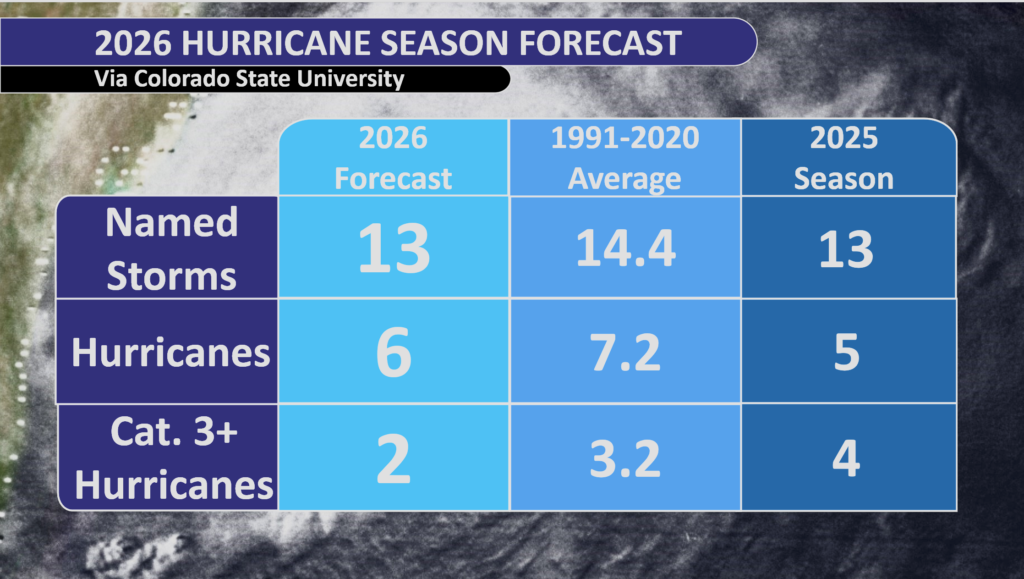
The forecast calls for 13 named storms (a tropical storm or a hurricane) including six hurricanes, two major hurricanes – a Category 3, 4 or 5 with maximum sustained winds of at least 111 mph.
This is slightly less active than average, and less than last season. The difference is that last season had four major hurricanes, while the forecast for this year calls for two.
Likelihood of a tropical storm or hurricane
Colorado State University also breaks down the forecast into probabilities for statewide impacts.
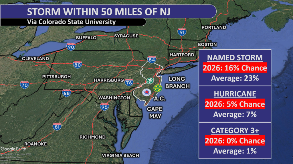
New Jersey faces a 16% chance of a named storm this season, which is 7% below the historical average. The outlook for hurricanes is also quiet: the 5% probability of a standard hurricane is below average, and the risk of a major hurricane – Category 3, 4, or 5 – is effectively 0%. That isn’t a major departure from the norm as the state’s average risk for a major strike is just 1%.
Virginia and Massachusetts are the only two states with a double-digit percentage chance of a hurricane being within 50 miles of their states, at 14% and 10% respectively. All other states are in the single digits.
El Niño, the biggest hurricane season factor
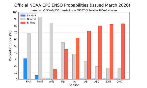
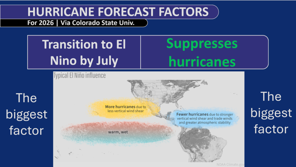
When we look at the hurricane forecast factors for 2026, the biggest one is the transition to El Niño, which we are expected to have by July. This suppresses hurricanes.
When you have an El Niño, that means you have warmer-than-average ocean temperatures off the equatorial Pacific Ocean. In other words, the ocean is warmer than average off the coast of South America, extending to about south of Hawaii. That helps rip storms apart as they try to develop and move westward across the Atlantic.
Secondly, the trade winds that blow from Africa to the Caribbean are stronger. That means more stability in the atmosphere and fewer storms. We are expecting to transition to El Niño during July or August, and we could even see a Super El Niño as we go into the late fall and winter. That impacts on our 2026–2027 winter forecast, which we wrote about in Shore Local April 2.
Other hurricane season factors
Beyond El Niño, all other factors point toward more activity than usual.
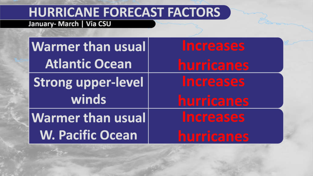
From January through March of this year, we had warmer-than-usual Atlantic Ocean waters, stronger upper-level winds and a warmer-than-usual western Pacific Ocean.
All of that, for different reasons, increases the likelihood of more storms.
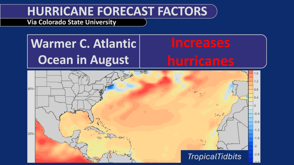
As we get to August, temperatures are forecast to be warmer than average in the Central Atlantic Ocean. The Central Atlantic is the key breeding ground for the long-track hurricanes that go from Africa to the Caribbean, and possibly up the East Coast of the United States.
So, imagine a tug of war – let us say one strong person matches up against four children. The El Niño-suppressing hurricane season is usually going to win out. However, you still have four smaller factors, the children, pointing the other way toward a more active season.
Learning from history
Colorado State University looks at analog years, or years with similar conditions going into the hurricane season as we have now. Four stood out to them.
More of the analog years point toward a less active hurricane season.
Another way to look at hurricane season
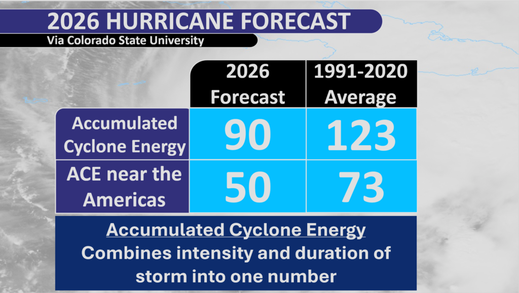
Accumulated Cyclone Energy, or ACE, combines the intensity and duration of a storm into one number. The stronger a storm is, the higher the ACE.
For example, Superstorm Sandy in 2012 had an ACE of about 13.5 on its entire journey from the Caribbean to a Brigantine landfall.
Sandy lasted for eight days as a tropical cyclone, peaking as a major Category 3 hurricane. This did not even include ACE potential had Sandy been a tropical cyclone during the time of landfall.
Meanwhile, Tropical Storm Fay in July 2020, which also made landfall near Brigantine, had an ACE of 1.5. Fay spanned just three days, and it was never more than a mid-range tropical storm.
CSU predicts a below-average year for total storm power, forecasting an Accumulated Cyclone Energy (ACE) score of 90 compared to the historical average of 123.
Closing thoughts
This forecast is good news for us at the Jersey Shore and for the entire Atlantic Hurricane Basin.
But remember, it only takes one storm to hit New Jersey for it to feel like an active season near us. Even last year, where no hurricanes struck the United States, we still had Hurricane Erin bring the highest summertime tide on record for much of the South Jersey shoreline.
NJ beaches generate billions in revenue, supporting thousands of jobs and businesses. If they erode, our economy collapses. Federal beach funding was cut in 2025. Only the American Coastal Coalition fights 24/7 in DC to restore it. Protect your beach and business. Join today: americancoastalcoalition.org
WEDNESDAY’S FORECAST | 1 heat record feel Tuesday. 4 more may fall away from the beaches the next two days. Plus, I think today is our first legit beach day up and down the coast. I’m talkin’ bathing suit, toes in the sand!
LiveNOW on Fox’s Andy Mac spoke to Meteorologist Joe Martucci about the 2026 hurricane season.
Researchers at Colorado State University are predicting a somewhat below-average 2026 Atlantic hurricane season, running from June 1 to November 30, with 13 named storms according to their calculations.
A special thank you to New Jersey’s own Katie Gallagher for the invite to the streaming channel!
SATURDAY’S FORECAST | We got wall to wall sunshine alllllll weekend long! Thank high pressure for that. There’s still the wildfire concern today. Otherwise? I spy our 1st LEGIT beach day in the 7-day forecast.
Our 24×7 Jersey Shore Weather Channel: https://www.youtube.com/watch?v=dcPpb_VycOM
Jolt your brand with the Shore’s top weather media company. Advertise today! joe@cupajoe.live
FRIDAY’S FORECAST | Yeah it’s gloomy this morning but I promise, the sun will come out! Once it comes out, it stays out this weekend. One concern? The possibility of wildfires. Like Smokey The Bear says, you can prevent wildfires.
THURSDAY’S FORECAST | I think we’re doing it! Thursday should be our last widespread freeze of the year at the coastal counties in NJ. It’s warmer air from here on out! That being said, drought probably gets worse.
Why settle for big chains? Choose Just4Wheels’ family-owned locations all across NJ! Rent brand-new sedans, passenger vans, box trucks and more today! Visit www.just4wheels.com or call 877-650-3500.
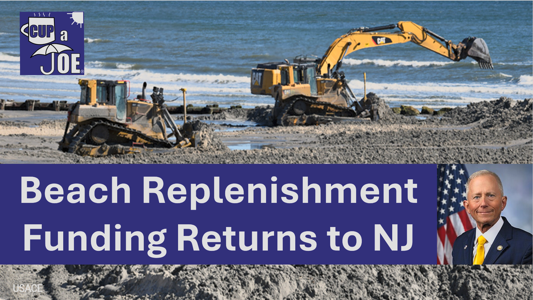
Beach replenishment projects are back on at parts of the Jersey Shore in 2026, just weeks away from peak beach season.
U.S. Rep Jeff Van Drew secured $99 million dollars from the Army Corps this week for beach replenishment.
Here’s what it is, and what it isn’t.
The $99 million is for beach replenishment projects that were slated to occur, but were discontinued after the congressionally directed spending ended in 2025. This money will come from “disaster funding”. $5 million in funding has already gone toward projects on the Maurice River, Cold Spring Inlet, Intracoastal Waterway and more.
The $99 million covers the projects in Rep. Van Drew’s 2nd district. At the Jersey Shore, that’s Cape May, Atlantic, Cumberland and Ocean county as far north as Berkeley Township.
Beaches in Stone Harbor, Avalon, Sea Isle, Strathmere and Ocean City will get the sand they need to keep the houses and roads safer from tidal flooding this year. However, when it’ll happen is still to be determined.
Photos and videos from Strathmere in particular has gone viral for the massive cliffs, or scarping, of beach that took places over the nor’easter season.
Rep. Van Drew says that he’s looking to secure $70 million in 2027 to complete beach fills in Long Beach Island, Atlantic City, Ventnor, Margate and Longport.
Van Drew also introduced the Coastal Trust Fund Act. If it passed, it redirects exists offshore energy lease` money already collected by the federal money and puts it into a trust fund for beach replenishment.
WEDNESDAY’S FORECAST | Woo, it’s cold out! Highs today will be more like February than April. Such is life during spring. Our last freeze of the season is likely Thursday. Then a slow climb up the thermometer is on the way.